“The Greenery” Revisited

Moment of rediscovery

Monday, July 27, 2020

My “Blue Elderberry Horse Trail” is set clearly in my mind now, eliminating needs to mess with electronic maps, pins, and waypoints. Ambling along a forest road, I rode Rosie who insisted on jigging-jogging along (another story!). I ponied Sunni, and as usual, my Pimmy in donkey-time was tagging (she now sports a cowbell that clangs her nearness). With us was (my single dog without a limp) Ranger, forever running in large circles to search for chipmunks.

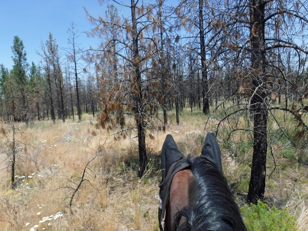
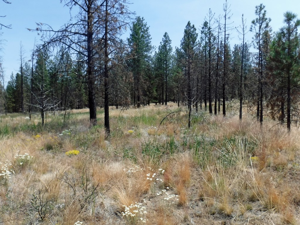
The road we were one was one from which I usually turn. Now following farther, it brought a big surprise by delivering my little parade to a section of forest that I call “The Greenery”. Now we were viewing from its topmost side. Up where we were, the forest is populated more with color, even more beautiful than down below at its lower road that’s on my “Blue Elderberry” map.

Upper section with flowers and greenery abounding

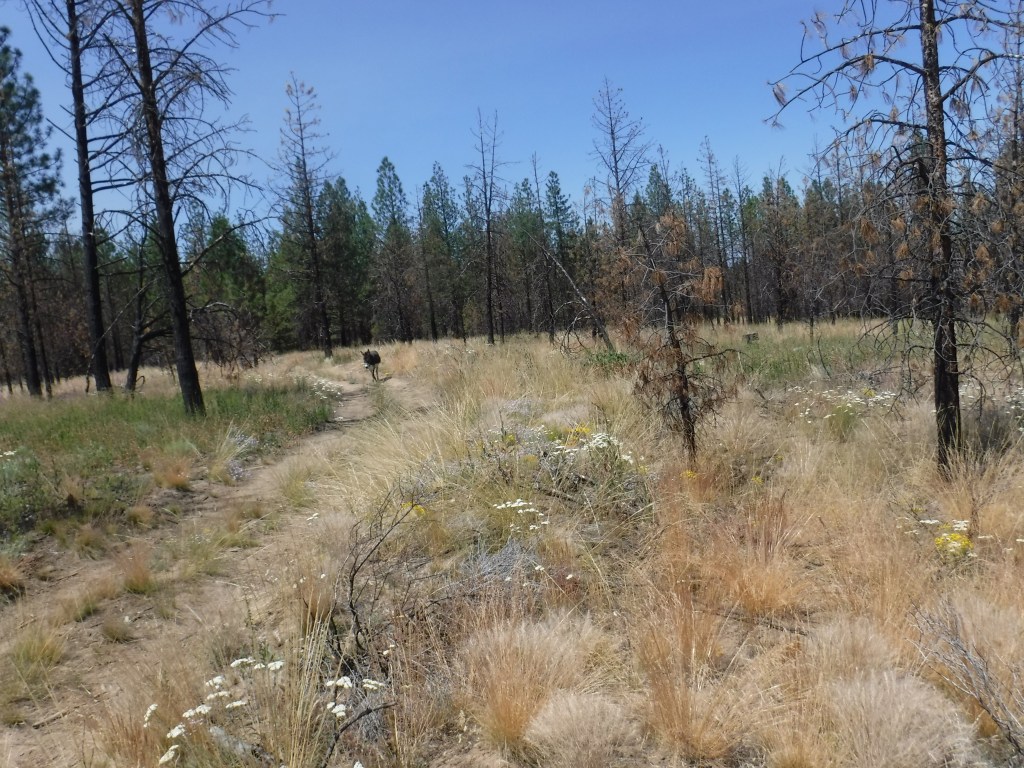
Our road went straight into and through The Greenery. This might be a road that our friend Susie spotted on a map, appearing faint and nearly obsolete. We were curious about it, and now in real time, I found it in fine condition. As we moved along through the area, our road curved and began to point us in a direction returning to the trailhead, two miles away. We followed the road until it again curved, and now in a direction opposite from the trailhead.

In situations of traveling on an unfamiliar road while managing several animals, I often become timid about going forward. This time, too, I decided to backtrack. As usual, I could return another day to explore more. I’m unclear as to why breaks in passages may boost my courage. Maybe it’s that traveling a new road gains familiarity and later invites returning and pushing forward.

Here cometh it, clanging cowbell

Later this week, I’ll ride with a friend and needn’t manage two horses. That topside Greenery might become our target area. If so, we may explore the suddenly-curving part of the road that goes in a direction away from the trailhead.

Dear Friends: My jigging-jogging Rosie, will be bridled, bitted, and will be listening to her rider. Diana

Ups ‘n Downs

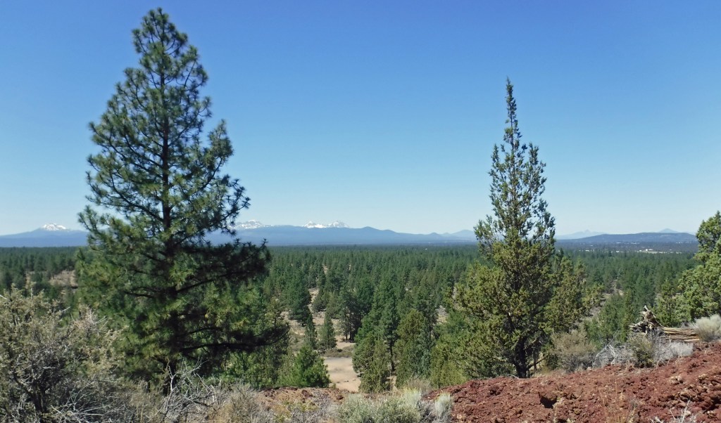
From atop Horse Butte, the Cascades, from Mt. Bachelor to Mt. Hood

Sunday, July 26, 2020

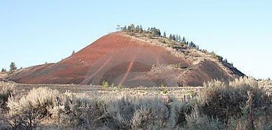
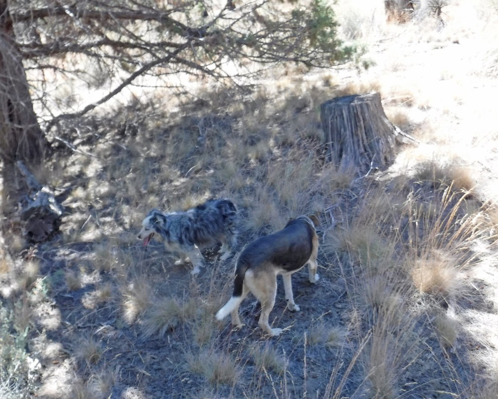
On a pleasant and sunny afternoon, the dogs and I hiked to the top of Horse Butte. We strolled its rim and made it about halfway around before I felt a need to turn back. The steep upward climb full of slippery scree kept me worrying about the potential problems of balancing myself correctly while descending. Soon after beginning to descend, I saw that the dogs had found and were on a lightly-worn sidepath. Their path appeared more-recent and slightly-easier, not any less steep but newer, and thus, with less scree than the original route. I shifted paths and followed the dogs. While coming down my boots did slip, but only once and slightly.

My brain continuously chanted, “follow the dogs”. They’ve a history with me of finding established trails and choosing the one easiest if they’ve a choice. Many times through the years, my dogs running ahead have guided my direction. I’ve followed them while on horseback, through grasses knee-high to my horse, and on worn paths invisible to me, that otherwise I’d never have found.

My most memorable “following the dogs” occurred soon after we reached the very top of a mountain where we found ourselves in a gathering and blinding rainstorm. Suddenly, on hearing thunder approaching, I realized that we had become the area’s highest objects. Unable to see a downward trail, I quickly pushed my horse to follow the dogs. They hurried us directly to lower levels and to a relative safety from strikes of lightning.

There’s more about yesterday’s adventure at Horse Butte, but I’m running out of time. So, the story of that adventure may be continued.

Dear Friends: Through the ages, high value in the relationship between humans and dogs. Diana

A Quest

Saturday, July 25, 2020

The dogs and I will go out early. We’re going to climb Horse Butte. I’ve returned recently to the Butte area and been riding horseback in its surrounding forest. Each time in the trailhead, I’ve been attracted to the Butte’s steep upward trail. I’ve a yearning to climb it, although for sure, nothing on top would have changed since last I climbed there, about fifteen years ago. This small extinct volcano has a sunken summit, populated with big lava rocks and junipers. I used to enjoy strolling on the outskirts of that sunken area or directly through the dipped-center.

Past memories of my experiences on the Butte are drawing me again to it, and as well the climb itself. The Butte isn’t very high, its upward trails are clearly defined. The trail I’ll use today, in the old days had slippery spots, and most likely still does. Back then support sticks helped to keep my climb safe, and today I’ll use them.

This draw to the Butte rouses more of my curiosity. I wonder if at the bottom line today’s plan is a test of my physical strength. While often my strength doesn’t seem much, over time it’s held up surprisingly. From past experience, I know that if climbing upward proves too much, descending is easy. Today if necessary, I won’t hesitate to turn back–but hey, I gotta give the climb a go.

Dear Friends: Wondering if this involves wishing to defy the laws of aging and gravity. Diana

Blue Elderberry Trail

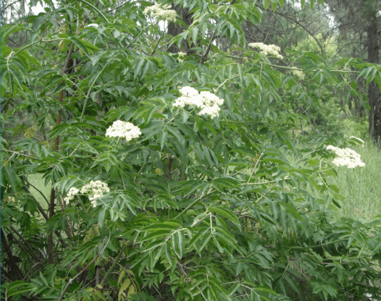
Blue Elderberry (mature)

Friday, July 24, 2020

Here’s a brief hello, for I must dash out very early to feed the horses. Today, my friend Susie will ride Rosie, and we will lead Dave and Julie Gilbert over the “Blue Elderberry Trail” at Horse Butte. The Gilberts are early go-ers, and so this morning I’m scrambling.

It’s fun to have identified a loop that’s (hopefully) new to the Gilberts, and to have invited them on a tour. The two are intrepid horseback riders, they do lots of exploring and have shown me many fun horse trails which otherwise I’d never have got a clue. Julie and I are book lovers who share information and ideas. Dave has introduced me to elements in the great outdoors (new to a former city girl), like lava ridges shaped with character, ancient trees with history and almost-identifiable stories, and lately, the fun of strolling with dogs in the forest to hunt for wild mushrooms.

Today, we’ll learn if my trail is one they’ve not already found. Even if they have, this will be a pleasant ride. One thing about “Blue Elderberry” I had hoped for was to have been able to create a hard-copy map of the trail. I did fiddle around with many online mapping opportunities, but none let me design exactly what I wanted.

BTW, Blue Elderberry is native to the PNW, and a relatively easy-keeper that can grow to a 30′ tree. Ours is young, and a stunning-looker, growing wild near a trail out in the middle of almost-nowhere. Today, my hands will be more free, I’ll take better photos of the plant.

Meanwhile, learning how to map, to get exactly the outcomes I may visualize, will be another ongoing project.

Dear Friends: The weather has cooled down, so enjoy this fine outdoorsy day. Diana

Miles, Ahead

Thursday, July 23, 2020

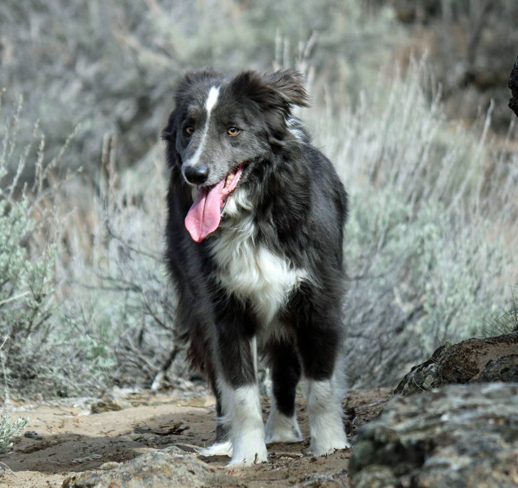
My nine-year-old Border Collie, Miles, has an appointment today to consult with a surgical specialist. That veterinarian has x-rays of a calcification that’s causing intense leg pain. The referring veterinarian said she’d never seen a calcification like this one impacting Miles. So, today, we’ll learn if his condition may be fixable.

If it’s a condition destined to be chronic, and Miles can handle pain reducers that don’t destroy other parts of his body, he’ll have a softer life. He won’t again run with the horses or participate in other extreme exercises. An intense athlete, he’ll be unhappy. Otherwise, my concern is that his sore leg might be unrepairable and gradually could worsen.

His other “condition” is his heavy, coarse coat. Don’t get me wrong, he’s beautiful, a “blue” Border Collie with the “dilute gene”. But his coat grasps and lodges field debris, like cheatgrass seeds and sticks. After months of closure due to CoronaVirus, pet groomers are slammed and not until mid-September could Miles have a coat-reducing session. So I’ll tackle the work, and today a set of dog clippers with blades is arriving. I’ve never groomed a complex coat like his, but it couldn’t look more awful than now–in moth-eaten condition after random scissor-hackings to find and eliminate unwanteds from the forest.

Dear Readers: Please root for an easy repair to his pain, and clipping by steady hands. Diana

Hay Day!

Wednesday, July 22, 2020

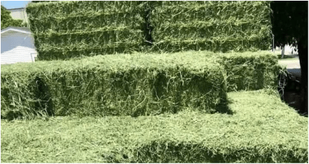
Hay is on its way, a big Hooray! for another year with stacked horse feed. Yesterday, I rambled around in the heat caring for the Big Ones–cleaning-up, repairing, feeding. It’s especially tiring in extreme weather to work at keeping equines. Key factors behind one’s success are physical endurance and penty of available hay. Annually, the hay delivery day has me sighing in relief.

When first I got horses, about fifteen years ago, hay was plentiful and cheap. There were lots of easily-found fellows who made livings by delivering hay full-time. Early in summer, after a phone order, my year’s worth of hay arrived in a few days, and (this is no small matter) got stacked.

Somewhere in the early 2000’s, America began emphasizing the use of ethanol, a corn-based fuel. This caused manufacturers to alter vehicles by building engines to accommodate ethanol instead of expensive old-style gasoline. Immediately, many farmers revamped their fields and moved from growing hay to growing corn. Ethanol production caused the price of corn shoot up, and of course, hay became scarce and it’s price shot up, too.

We who feed grass hay never dreamed it could become difficult to find. After all, horses need only plain orchard grass and that’s everywhere, or so we thought. But hay became harder to find (much is shipped to other states and to other countries) and grew more expensive. Some delivery folks dropped out of business. In some years, it was a sweat to locate available hay and find someone to bring and stack it.

Hay is more available now and still very expensive. The folks who deliver hay dependably are slammed with customers and often can’t accept new ones. Delivering and stacking hay is hard labor that’s done in summertime heat, and requires knowing how to stack safely. Over the years, I’ve learned to climb onto a stack, toss down bales, and importantly, avoid getting my boots stuck in crevices. An end user figures how safely to draw each bale from a stack, and maintains personal safety by totally focusing on the work.

With hay on the way, my large animals may eat through another year. Periodically, I’ll climb onto the big stack to lower individual bales. I’ll be aware of where my boots are placed, set hay hooks firmly into each bale so they hold well, and sense how to maneuver each bale so it may land safely in a designated space.

Lots of work, horses are.

Dear Readers: On this note I’m going outside, to feed and clear space for the gold en route. Diana

Path Seeking

Tuesday, July 21, 2020

I’m a deadhead today after spending most of yesterday looking at and thinking about maps. My next-door neighbor who’s a map appreciator volunteered to help, but also couldn’t solve the problems in trying to print an expanded section that’s easily readable and carryable. It’s possible to expand maps online and to add text and graphics, but those alterations won’t print-out enlarged, to read and carry.

Moving on and searching online for available “mapping” software that may help brings up bunches of stuff not relevant. Threads appear for mapping that may become surprises. “Mapping” finds software designed for mind-mapping, for groups in large organizations. Other mapping creates searches for products to shortcut online purchasing.

My cyber explorations will continue, for surely there’s assistance out there. The solution might be biting a bullet and just purchasing the Big Adobe Package. My limited version of Photoshop has helped to customize online maps but it doesn’t offer nearly as much as the big package. Right now, for my minor needs, the full Photoshop is too expensive to rationalize.

It’s hard if not impossible to know how much and where new learning might transport us. My interest in becoming enabled to map accurately might grow as I gain insight and understanding about the applications of mapping. It would seem be a reach, to justify obtaining a major software package, but nothing’s impossible.

Dear Friends: First, learn to use a compass, then a GPS, then a tracking software, and then…. Diana

Still Mapping….

On the trail, in a shady moment

Monday, July 20, 2020

Route mapping isn’t an activity for the fainthearted. I’ve been trying to lay out a horse-trail in a popular area appearing on official maps. I’m finding it “almost impossible” to overlay trail details from my travels and make them show on a printed map and readable. I say “almost impossible”, because I’ve not given up, although it’s unclear as to what more might help to achieve a decently readable map.

I’ve searched Google Maps, Avenza Maps, and All Trails Maps. All show only abbreviated versions of the area I want to enhance. By enlarging an online map, it’s possible to overlay names of key points and add general route directions. On a computer, too, the enlarged area is satisfying. Unfortunately, printouts of the map don’t retain an enlarged view. They shrink my altered area to tiny and unreadable.

This mapping is being driven by my OCD button that’s rambling out of control. I’m continually trying to visualize ways to create a hard copy map showing clearly my route design and key points. I’ve already written about this, and a reader has asked for location coordinates. Finding space for coordinates also is an almost-impossible.

None of this adds up to loss for I’ve come a long way since deciding to create a map. Eventually I’ll make it happen. I’ve learned lots, like how to use the previously unknown (to me) features on electronic devices. Electronic usage has enabled my outline of a five-mile loop, recorded key points with locations and coordinates, and ultimately, will make the loop a worthwhile destination. But, first the trail’s details must be made easily readable, printable, and pocketable while en route.

Dear Friends: I’m not the first wanting to make a map, somewhere is a solution. Diana

Great American Writers

Zora Neale Hurston

Sunday, July 19, 2020

Yesterday, I took my Border Collie, Miles, to the veterinarian. These days, they’re doing “curbside receiving”, a slow process, so I grabbed from my stack of waiting readables a book to crack while waiting in the car. The title happened to be, “Their Eyes Were Watching God”, by Zora Neale Hurston. She wrote this novel in 1937, during years known as the period of “Harlem Renaissance”.

That period is known, too, as the “great migration”, when blacks were leaving the South to escape a restrictive and brutal world of Jim Crow. They moved en mass to northern cities that had manufacturing processes and were creating available work, and also, moved West to the Golden State.

Those were the times of Hurston, a wonderful writer. Others, too, wrote beautifully–like, Maya Angelou, James Baldwin, Ralph Ellison, Langston Hughes, and Richard Wright. My early interests in literature and psychology led me to the works of these authors. They impacted the worldview of this Oklahoma-raised, somewhat backward young girl.

All that flooded my mind while becoming reacquainted with Hurston’s talent and perceptiveness. In years past, I tried to read “Their Eyes Were Watching God” and failed, because she had written much of its dialogue in Southern uneducated dialect. In those days I couldn’t slow down to absorb what her characters were saying. Yesterday, was different, for I felt strongly her characters’ sensibilities and qualities, and even more appreciated Hurston.

I’m running out of time and will close here. After finishing this book, I’ll write more about it.

Dear Friends: I’ll horseback ride today, focused still on mapping and wanting more specifics. Diana

Mapping Challenges

Saturday, July 18, 2020

I know, it’s tiring to read again of the trials and tribulations in my mapping project at Horse Butte National Forest. Laying out a horse trail became a preoccupation, it repeatedly returned me to the forest with horses and dogs, and lately, has had me learning to use a cell phone program that can track a horse and map its route. By now, the trail-identifying and electronic mapping might be done, for my cell phone clearly shows a route that appears correct. It has points that ought to be superimposed onto a printed map of the Forest.

A really-good printed map of Horse Butte Forest is hard to find. Today’s header photo is an example, it shows little beyond an area title. I went searching for my old map collection, left untouched for years. It consists of maps from when I began riding horseback in Oregon and searched for identifiable safe trails in public lands. All my Central Oregon Public Lands maps show Horse Butte National Forest, briefly and as a truncated area. Another challenge is to superimpose my recorded trail points onto one of the area maps scarce of terrain details. But, it’ll be a start toward something-more, whatever that may be.

It’s how a step-by-step process of learning works, and the journey is long. This project like others, began with an idea of identifying a horse trail, and wishing for a hard-copy map of that trail. Between that beginning and an upcoming ending were many searches. I’ve sought appropriate terrains with existing trails, tried ways of recording points over a meandering five-miles, and finally, sought help to identify helpful electronic tools and understand their uses.

Gradually my little single-chapter impulse has become a Medusa-like project. It has forced new branches of planning and learning. The next step, of achieving some kind of hard-copy map, certainly will force new branches. It’ what learning is about…we take an idea, make one step, then find a reason to take another, and so on, until eventually, on reaching a logical conclusion we have acquired new knowledge.

Dear Friends: This day won’t include horseback riding, it’ll be of creating a hard-copy map. Diana